LRT maps not ‘rail McCoy’
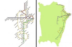
Two images known as the ‘Penang Rail Tran-sit Map’ circulating on social media have been described as visuals put together of something which has yet to be finalised.
State Traffic Management Unit chief engineer Lim Thean Heng said the superimposed images consist of a combination of loop alignments and transit corridors in Penang.
“The image tries to incorporate what has been conceptualised according to the Penang Transport Master Plan.
“It places together the loop tram alignments and the three transit corridors in the northern, southern and western direction in one map.
“Nothing is etched in stone as the Project Delivery Partner has yet to be appointed.
“It is just a visual to assist in planning. Further studies need to be done to determine the alignment or location of the stations,” he said.
Source: TheStar.com.my


